
Background to the Scheme’s Outline Design
The Project Stage 4 – Outline Design is a level of design that is appropriate for Scheme approval. This may be considered to be similar to the level of design that would be required for a Planning Application. It will determine the form, location, level and style of finish. It is not a ‘detailed’ level of design that would allow the project be constructed. For more information on this stage of the project please visit Detailed Design.
The Scheme is currently in its Project Stage 4 – Outline Design. This stage followed on from Project Stage 3 – The Options Appraisal Process (OAP).
The Scheme is being advanced under the PRINCE2 Project Management System. This sees the project set-up as discrete stages with each following on from the last, and with a gateway review between each stage. There are nine stages to the project’s delivery. At this point the first three stages are complete.
For more information about the previous Stage, Stage Three – The OAP, please visit Preferred Scheme.
Environmental Impact Assessment Screening Determination
East Lothian Council’s planning service determined that the Scheme should be subject to an Environmental Impact Assessment (EIA). This is for the purposes of Regulation 4 of the Flood Risk Management (Flood Protection Schemes, Potentially Vulnerable Areas and Local Plan Districts) (Scotland) Regulations 2010 (as amended).
The EIA assesses the effect of the Scheme’s design on the environment, and considers factors such as human health, ecology, biodiversity, the water environment, air quality, cultural heritage, and traffic. The Scheme’s design needs to be sufficiently developed before this assessment can be carried out. The EIA Report will be published, together with the Scheme documents, during the Scheme’s Statutory Approval Process.
The EIA Screening Opinion from East Lothian Council states the reasons for its determination and is in conformance with Regulation 4(5) of the Regulations. Read the screening opinion by clicking the link below.
How is the Outline Design being advanced?
The Project Stage Four – Outline Design of the Scheme is based on the ‘Preferred Scheme’ that was approved by East Lothian Council’s Cabinet during a meeting in January 2020. This Preferred Scheme is a concept that identified the preferred combination of flood risk reduction measures that were appropriate to reduce the flood risk to Musselburgh. Prior to that point there was no agreed approach therefore a design could not be undertaken.
The Project Stage Four – Outline Design was started in February 2020. At that point the Project Team delivered a presentation to a meeting of Musselburgh Community Council at The Brunton to confirm the Preferred Scheme, and identified the approach to advancing the design. It was decided that the design would be advanced through a consultative process with regulatory authorities, key stakeholders, and the people and businesses of Musselburgh.
The design was paused in early 2020 due to the commencement of the COVID-19 Pandemic, as it became impossible to undertake the design in consultation at that point.
Project Stage 4 – Outline Design – is not just about design. This stage also requires the Project Team to collect a lot more detailed information in the relevant areas, for example:
- Topographic Survey; (i.e. ground levels);
- Ground Investigation Survey;
- Structural Surveys (e.g. of the Inveresk Weir);
- Ecological Surveys – to feed into the ongoing Environmental Impact Assessment;
- Existing Public Utility information;
- Mapping of existing underground watercourses (e.g. the Pinkie Burn and the Musselburgh Mill Lade).
This work did not require public consultation, so this work was advanced through the 2020 and into 2021 through the COVID-19 Pandemic.
The design only re-commenced in summer 2021.
The Project Team is currently consulting through three main channels, namely:
1. With Regulatory Authorities which is predominantly through its Working Groups:
- The Planning, Heritage & Landscape Working Group;
- Roads, Structures & Access Working Group;
- The Watercourse & Coastal Impact Working Group; and
- The Public Utility Working Group.
2. With the people and businesses of Musselburgh. Please visit Consultation for more information about the consultation process, and to access materials presented at the various consultations.
3. With Key Stakeholders, for example:
- The Fisherrow Harbour & Seafront Association, who Cabinet authorised us to engage with as a partner organisation;
- Scottish Water – who currently own the upstream reservoirs at Edgelaw and Rosebery that we propose to modify to deliver flood attenuation benefits; and
- Upstream landowners on who’s land we propose to site our Debris Catchment infrastructure.
The design is being developed by the Scheme’s Design Consultant, Jacobs. Ultimately they will require to take a professional determination to define the design, however its approval will be ratified by East Lothian Council. They will consider all inputs from legislation, technical data, and the consultation in coming to a decision.
Designing in consultation
The Project Team recognise the unique character and cultural heritage of the town of Musselburgh. We also recognise that a one-size-fits-all approach will not deliver an appropriate design for the town’s proposed new flood defences. The Project Team are advancing the design through a consultative process and are encouraging people to become involved in the consultation process so that together we can shape the Scheme to suit the town and its individual local areas.
Since the Project Team could reconvene consultation in Summer 2021, consultations have been held in person or virtually due to Covid-19 restrictions in place at the time.
Throughout Autumn 2021, the Project Team undertook a series of Local Area Consultations. These events targeted residents living in the closest proximity to any potential flood defences and who would therefore be most directly impacted by the Scheme and its construction.
The local area groups were:
- Edinburgh Road
- Mountjoy Area
- Fisherrow Area
- Goosegreen Area
- Esksides Area
- Eskmills Area
- Inveresk Area
Two further combined meetings of Local Area Consultation groups were held in February 2022. Consultations with these combined groups were also held through 2023.
These combined local area groups were:
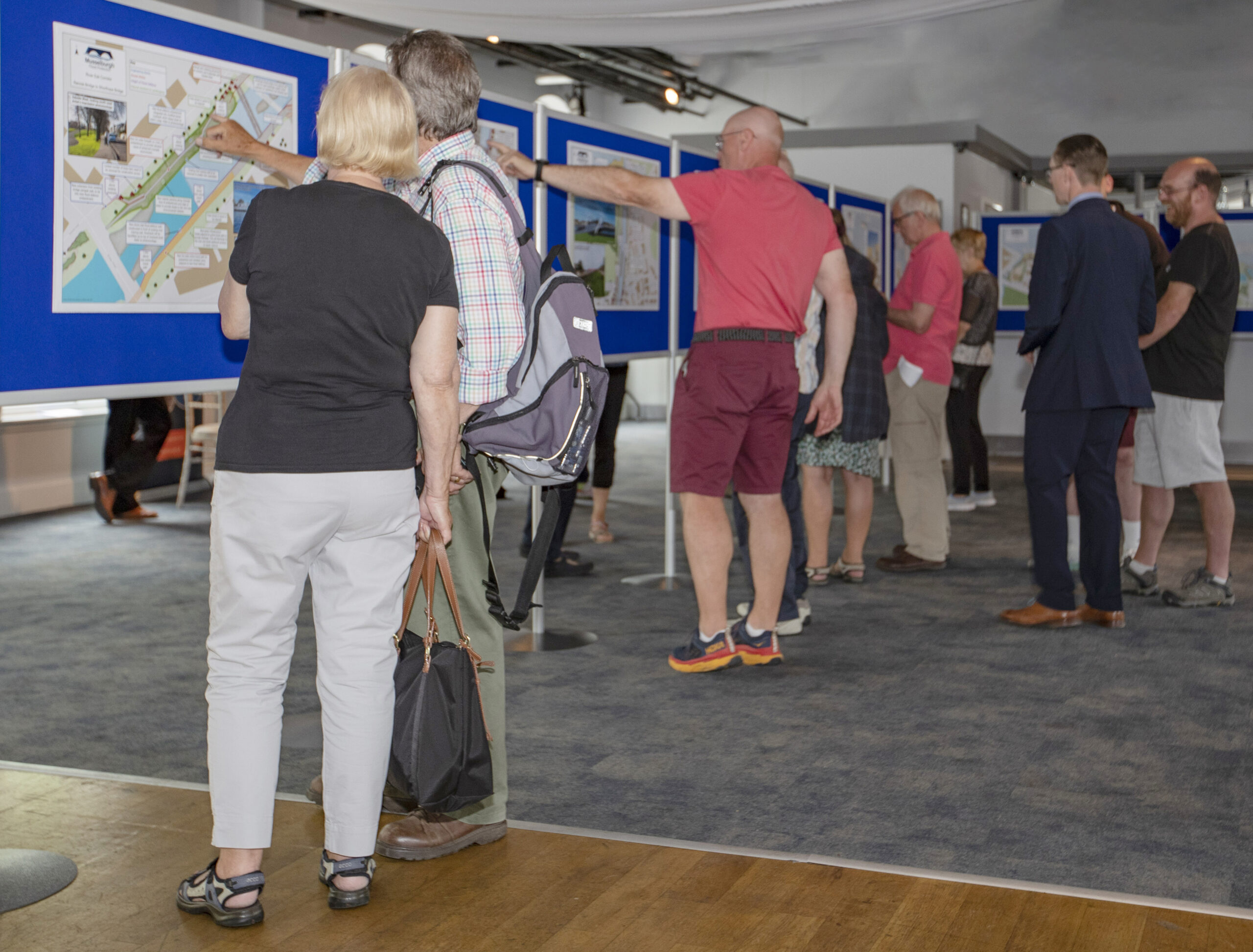
Whilst the residents living in the closest proximity to the Scheme’s footprint were directly invited, the evenings were open to anyone who wished to join, and several members of the public attended multiple evenings.
On March 8th 2022 the Project Team also hosted the Musselburgh Area Consultation for the Whole Town at The Brunton Theatre and online through this website. The event was a drop-in session to answer questions the public may have, and to gather their thoughts on the risks and opportunities associated with various design concepts.
The initial vision of the Outline Design was presented in June 2023 at the Scheme’s Public Exhibition at Eskmills Venue. It provided an opportunity for members of the public to view the design, discuss the design with the Project Team, and provide their feedback. You can access all the materials from the event, including the key themes, design maps and the 3D animation at Public Exhibition No.2 – June 2023.
Please visit Consultation for more information about the Scheme’s consultation process and to access the various pages for past consultations – including material such as information boards and videos from the events.
Please also visit Contact Us to connect with the Project Team.
Will the Outline Design be published on the website?
The Outline Design will be published on the website. The first vision for the Outline Design was presented in June 2023 at a large-scale Public Exhibition held at Eskmills Venue.
The Outline Design aims to deliver flood protection, enhanced landscapes, natural solutions, and a managed adaptive approach to future flood risk. It will bring together four projects: Musselburgh Flood Protection; major repair works to the existing Ash Lagoon Seawall; significant parts of two routes of Musselburgh Active Toun; and a range of river restoration interventions through a new multiple-benefit project, Musselburgh River Esk Restoration.
You can view the initial vision for the Outline Design, including the key themes, design maps and the 3D animation at Public Exhibition No.2 – June 2023.
This webpage will be updated with the final vision for the Outline Design once the design is complete following further consultation.